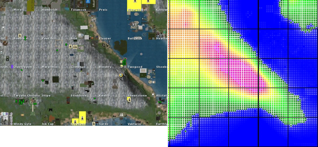
Land and altitude map of Mountains Of The Prim
The Mountains Of The Prim are a Geographic Structure located inside Corsica continent. It can also be considered a Subcontinent if we consider all sims that share the plateau.
Etymology[]
On top of these mountains, in Kwaito sim, is located the Temple Of The Prim. This construction is also connected to a mountain road and is on the highest place. It looks like the mountain complex was built for the temple. This is why the temple gave its name to the entire mountain complex.
For a long time SLGI team was confused, whether to consider it as a mountain structure or as a plateau. It is true that the area hosting the temple is a plateau, but is surrounded by steep grades. However, a more elaborated research, with the help of an altimeter, revealed that there is less flat area then area with high slopes. So, the place can be considered a mountain.
Geography[]
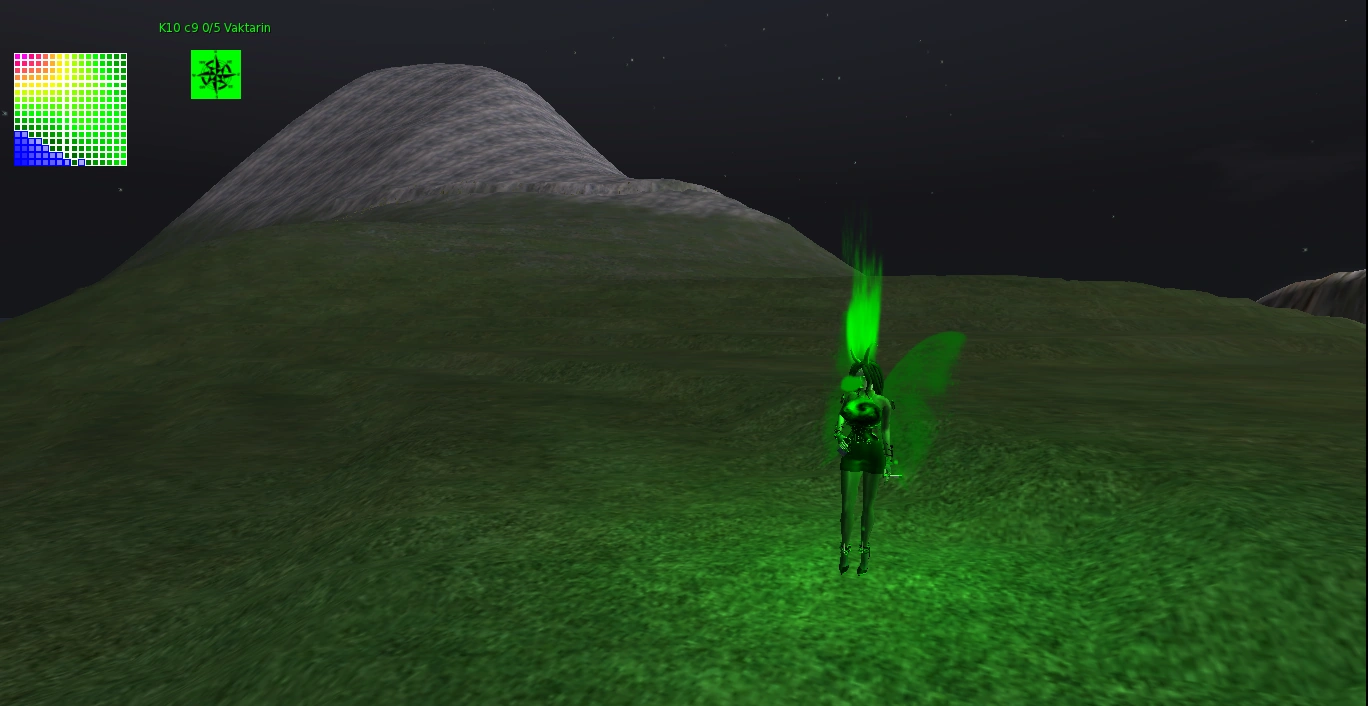
A view from Vaktarin
The mountain complex has an elongated form, oriented South-East to North-West. The Eastern end is in Starstrider sim, where it forms a peninsula and reaches the shores. At the sim corner separating Starstrider with Vaktarin, altitude reaches a maximum of 54 meters. From here, the high mountains are clearly visible.
In Sheerstone, altitude reaches 165 meters. This is the Eastern end of the plateau, from here, it becomes a mountain range until it reaches center of Vaktarin sim.
The temple is placed on a large plateau that covers most of Kwaito sim. This rocky plateau, without any sign of vegetation, make you think about the mountains found on the Moon. There is no other building except for the temple, no tree and not a single spot covered with grass can be seen. All is deserted around the temple. Average altitude is 167 meters, the highest point being temple foundations (173 meters). All this plateau is bordered by highly inclined terrain. To North-East, a road connects the temple with the NE sim corner.
If someone adventures further to West, the plateau becomes wider and its borders more easy to climb. In Stinkhorn sim, there is a very rounded peak, reaching 165 meters high. Futher North, in Gomphus, a mountain peak can be seen. It reaches 155 meters high and borders the plateau to North.
Another peak is located further West, in Marasmius sim. It has 150 meters high. At this far, we can no longer speak about mountains. The plateau is wide enough and its border slopes are not so abrupt.
Temple Of The Prim[]
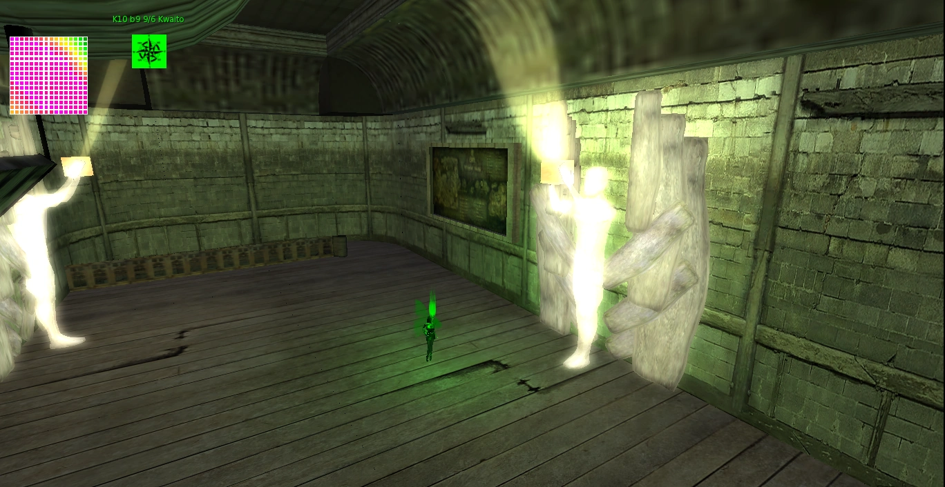
The prim of life
The temple is a large building, looking more like a fortress. It has massive gates. Visitors first enter an outer court, then climb to the main entrance. Here, warriors can move on the walls, to protect the temple from virtual invaders. Inside the temple, there is a large room with 3 statues made of light, each one protecting the ancient prim of life.
If one wants to explore further, take the stairs located in East corner of the room and go down. There is a second room below. And if you take the stairs even deeper, you will reach a secret place, where sunlight never reaches but where is plant life. A river is also flowing there, the River Of Life.
Mountain Road 11[]

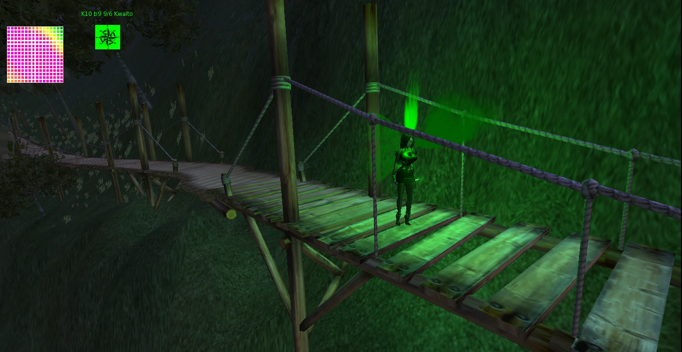
Mountain road to the temple
Road 11 is actually a path that can be used by a bicycle, a motorbike or a horse, but never by a car, be it even an off-road vehicle. It starts at the North-West end of Kwaito sim, close to water, where is also a rezz zone. The road is divided in two parts.
The unpaved road goes up and climbs to reach the temple. For people who love mountains, it is a lovely experience. Some people with more experience can try to climb the mountain in a straight line, but this is much harder.
The other road is made of wood and suspended by ropes. It encircles the mountain complex to the Southern side. This road is also too narrow for a car. Also, for its last part, land has only a few spare prims, meaning that any vehicle (with seated avatars) having more then 8 prim land impact, will not be allowed to enter. The road extends from Kwaito to nearby sims Vaktarin, at an altitude of 40 to 60 meters. Vegetation is present and landscapes are great.
Those who wish, can continue exploring further away from Vaktarin road end, to see how mountains slowly transform into a plateau. As far as Stinkhorn, there is enough abandoned land to walk on. Further away, you will exit mountain area.
In past, the wooden road extended one sim further.
Transportation[]
As shown above, there is road 11, that allows visitors to explore the area. The road is not directly connected to the ocean and there is no public rezz zone on the shores. However, there is a rezz zone on the road, for vehicles.
The Yava Script Pods sends a vehicle here every 30 minutes. From SLGI Fleet, the Voyager comes to explore the area every 6 hours.